


RUTLAND 7 Voting District, Kane County, Illinois
About
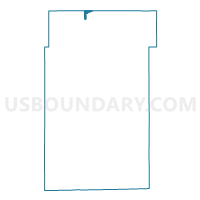
Outline

Summary
| Unique Area Identifier | 571434 |
| Name | RUTLAND 7 Voting District |
| County | Kane County |
| State | Illinois |
| Area (square miles) | 0.67 |
| Land Area (square miles) | 0.67 |
| Water Area (square miles) | 0.00 |
| % of Land Area | 100.00 |
| % of Water Area | 0.00 |
| Latitude of the Internal Point | 42.14894730 |
| Longtitude of the Internal Point | -88.46608100 |
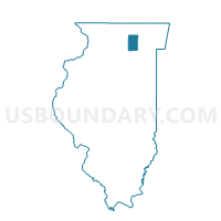
Maps

Graphs
Select a template below for downloading or customizing gragh for RUTLAND 7 Voting District, Kane County, Illinois


Neighbors
Neighoring Voting District (by Name) Neighboring Voting District on the Map
- Coral 3 Voting District, McHenry County, IL
- GRAFTON 26 Voting District, McHenry County, IL
- GRAFTON 27 Voting District, McHenry County, IL
- HAMPSHIRE 2 Voting District, Kane County, IL
- RUTLAND 2 Voting District, Kane County, IL
- RUTLAND 4 Voting District, Kane County, IL
- RUTLAND 9 Voting District, Kane County, IL
Top 10 Neighboring County Subdivision (by Population) Neighboring County Subdivision on the Map
- Grafton township, McHenry County, IL (53,137)
- Rutland township, Kane County, IL (18,806)
- Hampshire township, Kane County, IL (7,569)
- Coral township, McHenry County, IL (3,552)
Top 10 Neighboring Place (by Population) Neighboring Place on the Map
Top 10 Neighboring Unified School District (by Population) Neighboring Unified School District on the Map
- Community Unit School District 300, IL (110,689)
- Huntley Consolidated School District 158, IL (42,582)
Top 10 Neighboring State Legislative District Lower Chamber (by Population) Neighboring State Legislative District Lower Chamber on the Map
- State House District 49, IL (154,080)
- State House District 64, IL (132,417)
- State House District 63, IL (122,290)